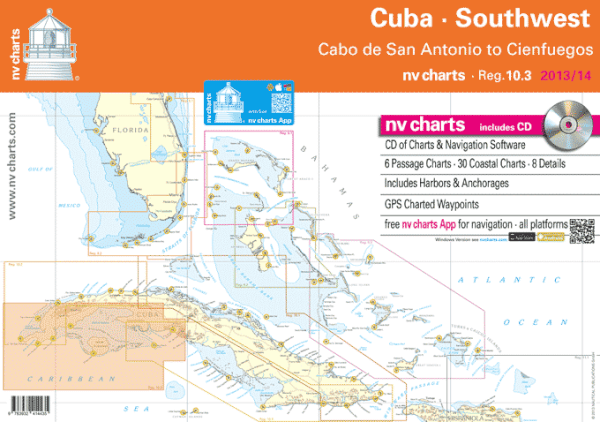
nv charts announces the release of their new chart set for Region 10.3 Cuba Southwest, covering the southwestern coast of Cuba. This new, updated, meticulously surveyed chart set has been much anticipated by sailors in the Caribbean who have wanted to visit the southwestern coastal area but have been reluctant due to the unavailability of reliable charts.
Region 10.3 sets, as well as nv charts’ new 2014 edition of Reg. 11.1, Puerto Rico, will be available at the nv charts booth at the U.S. Powerboat Show in Annapolis, MD., October 3 – 6, in Tent C, booth C31; and at the U.S. Sailboat Show also in Annapolis, in Tent C, booth C1, October 10-14. The new chart sets are available as Combi-Packs, selling together at a discount.
nv charts Region 10.3 is provided in paper and digital format for sailors, motor boaters, fishermen and professional mariners, and cruising enthusiasts. It includes 6 Passage charts, plus 30 Coastal Charts and 8 Detail areas, e.g., harbors and anchorages, all in a manageable set that is designed to fit neatly on a chart table. It includes a CD with all the charts in digital format for navigating with a PC, GPS charted waypoints and approaches. This chart set is based on reliable data from various sources including nv charts’ own survey data, with a new layout, clear cartography, and international chart standards.
Nv charts offer unique features not found in other chart sets, e.g., more distinctive shore and shallows cartography, aids to navigation and light characteristics, tidal information, and even helpful pages in the back outlining symbols, legends, and other data that help the navigator interpret the information in the chart. The cartography is visually distinct; unique color differences make specific depths, shoals, reefs, exposed tidal areas stand out for quick, easy recognition. Also, lighthouses illustrate their light characteristics for better identification. Legend pages at the back of the set provide a guide to symbols, legends, and other data that help the navigator interpret the information in the chart.
nv charts produces charts for mariners in paper, digital format for use on PCs, and provides a free App for navigation with all iOS and Android mobile devices. nv charts products in digital format are also available on SD memory cards for chartplotters including Lowrance, Simrad, and B&G chartplotter systems, and are compatible with all instruments in the Lowrance HDS Series, Gen. 1 & 2; Simrad NSE, NSS, and NSO systems; and all B&G Zeus series systems.
nv charts in all available formats can be easily purchased online; visit www.nvcharts.com.
About nv charts
nv charts began producing charts for navigation in Germany some 30 years ago. nv charts are used by cruisers, racers, the Baltic-Kiel-Pilots, and the US Coast Guard. US regions are based on NOAA and other data with the company’s own additional surveys and supplemental cruising information. nv charts produces about 600 charts and over 1000 details and harbor plans. These charts are designed with the prudent mariner in mind; coasts and anchorages are regularly updated through new surveys and aerials. Having charted harbors, checked georeferencing points, and double-checked buoys and lighthouses, nv charts offers the newest cartography in both paper and digital format. For more information, and online ordering, visit www.nvcharts.com.


