
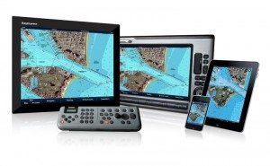
Probably some of the most overlooked aspects in purchasing the right chartplotter are the charts themselves. You may have the most technologically advanced chartplotter with all the widgets and wonders but if the charts are lacking in detail and quality the chartplotter will serve little purpose other than looking impressive to your friends when powered up.
“… if the charts are lacking in detail and quality the chartplotter will serve little purpose…”
Close examination of the charts offered in today’s chartplotters will clearly show there are some substantial differences between them. Not all charts are created equal and a good look at the varieties available will help determine which chartplotter is best for you. Chartplotter manufacturers offer their charts in different formats and with differing augmentation.
Many of the current chartplotters offered today have some form of a base map pre-loaded into the machine. Many plotters will have charts that are adequate to navigate by (always with the caveat that a good skipper will always have paper charts aboard and will never rely solely on electronic navigation) with details including channel markers, spot soundings, depth contour lines and detailed coastal outlines.
Others, such as the more basic machines or chartplotters that are intended for use outside of the US, have rudimentary charts that will only give a very simplistic view of where you are in relation to land masses around you. For some, who only need a latitude and longitude, these rudimentary charts are adequate, but for the rest of us we want the most detail we can get.
Some may opt for the plotters offering these simple charts to save on initial cost – but BEWARE. You may have to purchase chart cards to add to the machine (not always possible with all machines) and that can get expensive. In fact, one should always take into account what the cost will be for the cartography coverage you will need to add to your plotter for the waters you will travel.
We will get into the specifics of the cartography offered by each of the major players in the chartplotter business as we cover their product offerings in upcoming manufacturer specific articles. The variety of cartography they all use is surprisingly varied. They are not all using rastorized (digital versions) of NOAA and Admiralty charts but also use other formats of navigation information to make up their charts.
Navionics www.navionics.com even now offers charts that contain user soundings and navigation information to make up charts that are updated daily.
Garmin www.garmin.com uses a combination of standard charts and information gathered by their own surveys to augment the charts.
There are even companies www.standardmap.com that specialize in data cards that you can plug into your machine with pre-calculated routes that will route you through difficult areas right on your chartplotter.
Other cartography available today will display 3D versions of the chart and render a realistic dimensional view of the ocean bottom.Along with aerial photography and highly detailed fishing charts your chartplotter can be a highly detailed navigation device when these charts are added to them.
Picking the right chartplotter is important, but just as important is making sure the charts it displays will help get you to your destination safely.

