

After months of unrest, on April 9, 2021, St Vincent’s La Soufrière volcano exploded violently, covering St. Vincent, the Grenadines, and Barbados with ash fallout. Now after close to two months, the volcano eruption phase has been classified as “orange”, down from “red” eruptive levels; this could change at any time. The volcano, while not dormant, has entered a quieter phase. This event is being continuously monitored by the University of the West Indies, St. Augustine, Trinidad and Tobago, Seismic Research Centre (UWI-SRC). The center is the official source of information for earthquakes and volcanoes in the English-speaking Eastern Caribbean. A 3-person team composed of senior scientists and technicians from The UWI-SRC and the Montserrat Volcano Observatory (MVO) is currently on island. This team, based at the Belmont Observatory, works closely with local authorities to monitor the volcano. Scientists are observing for possible changes, however, the St. Vincent situation seems stable per reports from http://uwiseismic.com

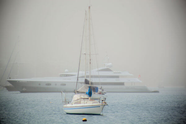
Life in St Vincent and the Grenadines is going back to post COVID normal, stores, restaurants and cafes are open, wifi works, and boats are on anchor harbor in Bequia and southern anchorages of St. Vincent. The Tobago Cays and the rest of Grenadines, due to the COVID situation, are experiencing low occupancy. In the Grenadines, where it was hard to anchor in the past, few boats swing at anchor; it’s back to the 1950s-60s flavor for the now quiet anchorages.
Regarding country entry, the only place vessels can clear into St. Vincent and the Grenadines is Young Island/Blue Lagoon. Boats arriving from other foreign ports must go to St. Vincent first. However, as of May 20, 2021, there are no issues there, cruisers are reporting enjoying other St Vincent anchorages such as Cumberland. Boats are told to avoid the northern part of the island, whether for stopping or even sailing close to shore. Airports are open for support services, and airlines such as Virgin are planning to restart commercial services. Ferries, while still utilized for supporting resupply, are back in post-COVID operations. Recovery is in progress.

In the first post eruption period, vessels in St Vincent, and Bequia faced ash fall, centimeters and in some locations, inches deep. Most boats evacuated south, leaving the island for the Grenadines and then further south to Carriacou and Grenada. No one knew what might happen, a massive evacuation of people from the red zone around the volcano occurred; boats rapidly left, heading south in ash fall. One boat crew Captain David and First Mate Nikki Bettis, on SV BooRei, not only were sitting in a cafe in St. Vincent when the first eruption happened, they experienced the ash effects as they sailed south at hull speed towards the Grenadines. The ash coated SV BooRei’s 42 ft topsides, evenly spread several cm over dodger windows, with gray/white ash finding every nook and cranny inside. David Bettis covered the engine air intake vents, they both wore masks and goggles. They reported frequently on status during passage, a rather concerning exodus. Boorei finally dropped the hook in a friendly Grenadine harbor, sitting and waiting out the next days. It took Nikki ten days to get the ash dust cleaned up. They communicated with photos to Facebook and comments over the long weeks of waiting out the eruption. Per fleet maps, most boats were gathered in the southern part of the Grenadines, few headed west.
Warning was given to wear masks and goggles, not breathe in ash, not run reverse osmosis systems if ash in the intake water, and rinse, not brush off, to clean off ash deposits. The ash is bad for air intakes, boats put covers over intake ports, and cleaned filters frequently. As mentioned above, boats from St Vincent and Bequia areas headed to Tobago Cays or at least the more southern areas of the Grenadines. Per Nikki, of Boorei, it really did not make much difference as to ash where they finally anchored; ash fall was all the way to Grenada, who got a light dusting. Barbados faced heavy ash fall, it was as dark as night midday when winds from the west and south west moved ash clouds over the island. St. Lucia, not only had a view of the eruption from the Pitons, but also a slight dusting during the first eruptions. Now that all has resolved, only ash on lands around the volcano and swept down slopes in lahars is a problem. The most recent images of the volcano show denuded slopes, a gray dusty ash covered rocky mountain, a lahar generator in seasonal rains.

While at first there was tremendous concern regarding the pandemic, due to the low vaccination numbers of only 14K out of approximately 110K citizens. Shelters started major COVID testing and immunization efforts. Several commercial cruise ships stood by to expatriate citizens to St. Martin, but finally left with just US and UK citizens. St Vincent’s population wanted to stay with their homes and families. Then as time passed, the feared full blown epidemic in the shelter environment did not happen. Numbers peaked, but the most recent count was two new cases. The island has, as of recent count, a low percentage of cases.
Currently, for passage around St Vincent, boats should be aware to give leeway around the northern red zone. Approximately the northern 1/3 of the main island is under Orange alert due to possible ash venting; but the main concern is due to lahars. Lahars,mudflows with large rocks, trees and debris, can move at miles per hour, and scour out river beds, buildings, towns, land and roadways. These lahars, have reached all northern coastlines such as Sandy Bay on the east, on the west and on the north sides of the ‘red zone.” See information, guidance and the photo gallery at http://nemo.gov.vc/nemo. Most recent flows are caused by rain washing down loose debris and ash from the volcano slopes. The concern of the danger is clearly indicated by the warnings in the weather reports provided daily by St Vincent’s National Emergency Management Organization (NEMO). Additionally, vessels should plan to keep a watch for debris in the waters around the island. Trees or lumber or other floating objects and passaging vessels do not mix well.

Bequia is experiencing a resurgence in visiting boaters, clearly found in both the filling anchorage but also in the open restaurants and cafes. It’s business as usual for Bequia and some southern harbors of St. Vincent. A good site to check for current openings, menus and events is the free and local online www.begos.com; this website also lists COVID information, provides links to government sites for customs and more. Also donation and supply needs are listed; various foreign countries are continuing to send donations; the needs are ongoing even when the media outlets find other topics of interest. The most important information to know is not only the status of the volcano and COVID, but donation sites. Several non-profits, such as Rise Up Bequia, and Action Bequia are listed at BEGOS, as well as government donation agencies, all of which go to help the impacted people of St. Vincent. Evidently there have been bogus money schemes, stealing much needed rebuilding funds.
With the downgrading to “orange,” life in the southern area of St. Vincent has returned to as normal as an island can with approximately 20,000 evacuated people living in shelters and or private homes in the southern areas of the island. Life has a new normal for these people, nights in shelters and days going back ‘home’ if they can to clean up, rebuild and take care of their property. Agriculture has certainly been affected, the weight of ash covering plants has broken branches. The heat of the ash, the larger gravel ash deposits, from both heat and weight impacts both ground crops and fruits/bananas. It will take years for production to recover in some areas. However, ash is fertile, and once worked into the land, as in the 1902 and 1979 events, plant life grows back at tropical speeds.

The COVID situation, with the St. Vincent government willing to vaccinate visiting cruisers, did not seem to be an issue for those boats passaging south away from the impacted areas. The crew of Boorei were vaccinated at Union Island with the COVID vaccine used in St. Vincent, Oxford/Astrazeneca.
They were vaccinated prior to the eruption, as cruisers took part in the program. This helped passaging, as with COVID vaccination, Grenada has loosened requirements for yachts/crews. Entry regulations are easier. For example, vessels sign in via Sailclear, then make mooring arrangements with Dockwa. Currently, Dockwa is providing a mooring area, partnering with Grenada to provide an official quarantine area for boat entry. Other areas/countries have deployed various strategies in a similar fashion.
St Vincent is developing a rebuilding plan for the island’s infrastructure and evacuees. Sadly, as in Sandy Bay, some or many may not be able to return to their old homes, lahar damage in some areas has redesigned the entire landscape. The infrastructure of the northern 1/3 of the main island, roads and water systems have been severely damaged. However the electric grid was rapidly restored, but not so much to the homes who collapsed or were damaged by ash fall, earthquake and flooding/lahars.
During COVID, and now during the post eruption phase, Seven Seas Cruising Association recommends to check local country requirements and also review the latest information on www.noonsite.com; this site is updated by a volunteer group feeding information worldwide. Seven Seas Cruising Association(SSCA) and Ocean Cruising Club(OCC) organizations are all collaborating in this “years long” effort to keep cruisers informed via Noonsite as the major information hub.
It will take time and a definite plan to rebuild infrastructure, homes, livelihoods such as St Vincent tourism. St Vincent is resilient, will experience “tropical speed” recovery of the environment, and is opening up for tourism again.

